Understanding Minnesota's transportation network
 A two-part look at Minnesota’s transportation network and how both roads and mass transit are paid for. This was published as lawmakers were debating major changes to how the state funded transportation. (Pioneer Press, 02/15/2015.)
First came a primer on roads and bridges, explaining it as simply as possible as lawmakers debate major road-funding changes. I talked about the extent and health of the system (some of it unknown), how much it costs to maintain it, and where the money comes from.
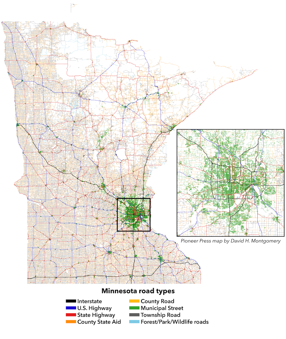
I also created a number of maps and charts to help illustrate the road system, and integrated them into the online story.
(In a companion blog post I delved into more detail in the traffic disparities of Minnesota’s roads.)
A few weeks later I took a similar look at mass transit, including the extensive metro-area system and the less-understood rural networks. (Pioneer Press, 04/01/2015)
 One key factor to understanding mass transit is the divide between two types of users: “riders by choice” and “riders by necessity.” The former could drive to get places, but choose to take transit if there because of its convenience; the latter don’t have access to cars and are so dependent on transit. Targeting the system toward the former can make the most difference in people’s lives — but targeting the former can have bigger impacts on congestion since only riders by choice have cars you can take off the road with a well-designed transit network.
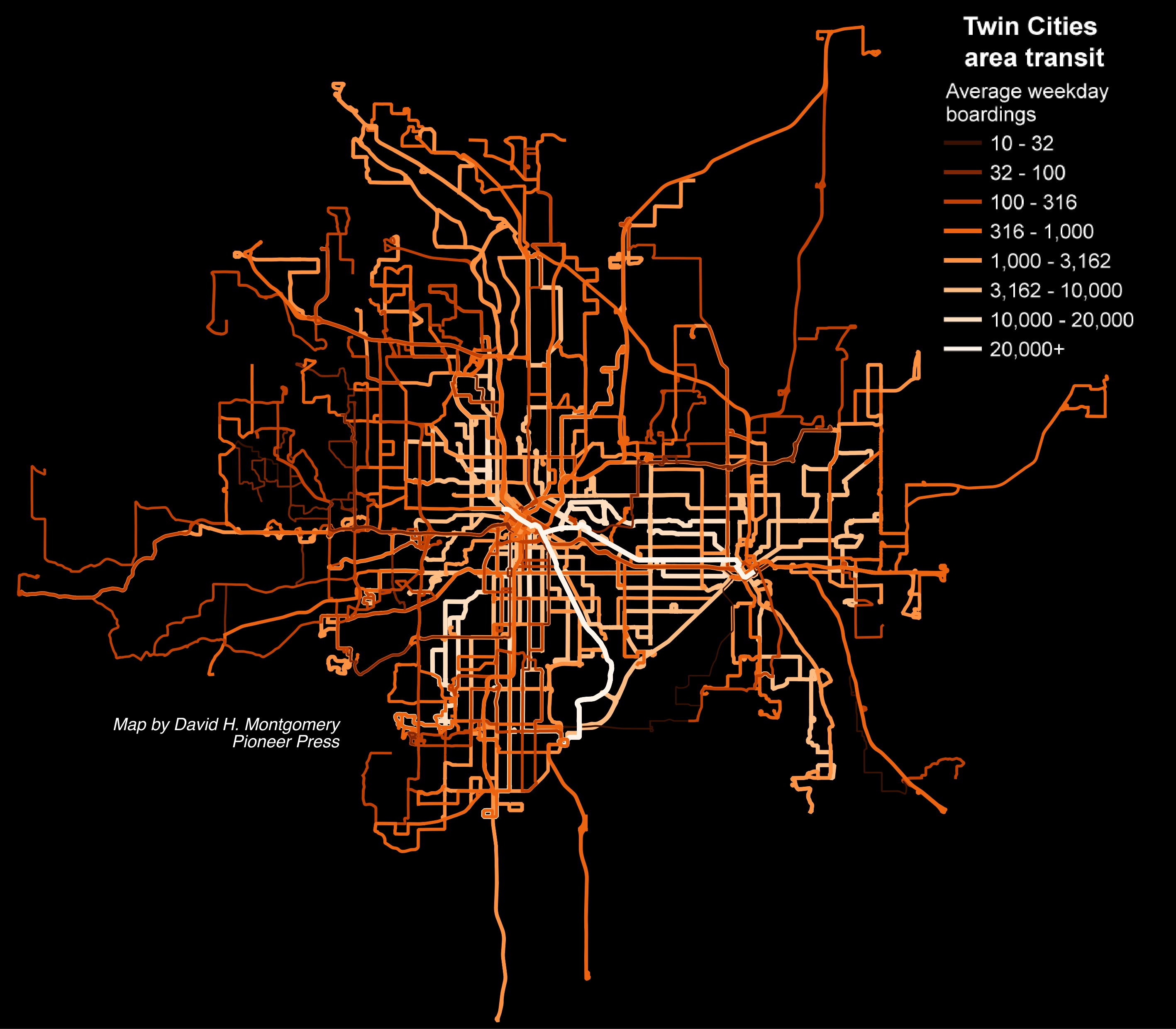
As with the look at roads and bridges, I illustrated the story with maps and charts. At left is a map showing all the transit routes in the Twin Cities metro area, colored by average weekday boardings. You can read more about that here.
Other maps include a version showing just the 10 busiest routes in the Twin Cities and an illustration of mass transit in more rural areas.
Below are the original print versions of the two stories: