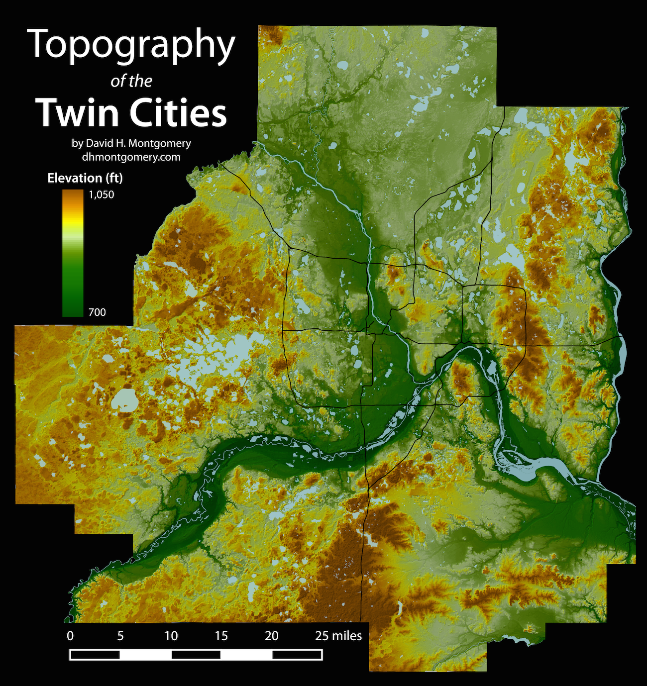
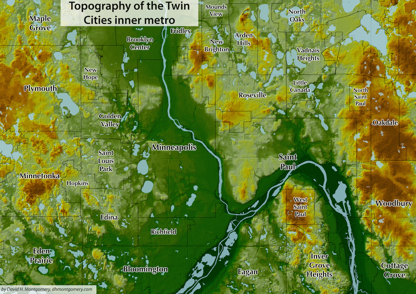
Ancient glaciers shaped these Twin Cities. Here's how.
I created topographic maps of the Twin Cities and then spoke to experts on geology and human geography to explain the notable features on the map.

Retreating glaciers have dotted the Twin Cities with hills and lakes, while a pair of powerful rivers have cut deep gorges through those same hills. The differing fates of Minneapolis and St. Paul can be explained to some degree by geography — the flat fluvial plain of Minneapolis versus the hilly balkanized neighborhoods of St. Paul.

You can view the print version of this story below, and an online version with higher resolutions and extra maps, including an animated map, here. (Pioneer Press 1/1/2016)